Mapping critical freight and passenger rail corridors
Through the National Rail Action Plan (NRAP), the NTC along with industry and governments has developed the National Network for Interoperability (NNI).
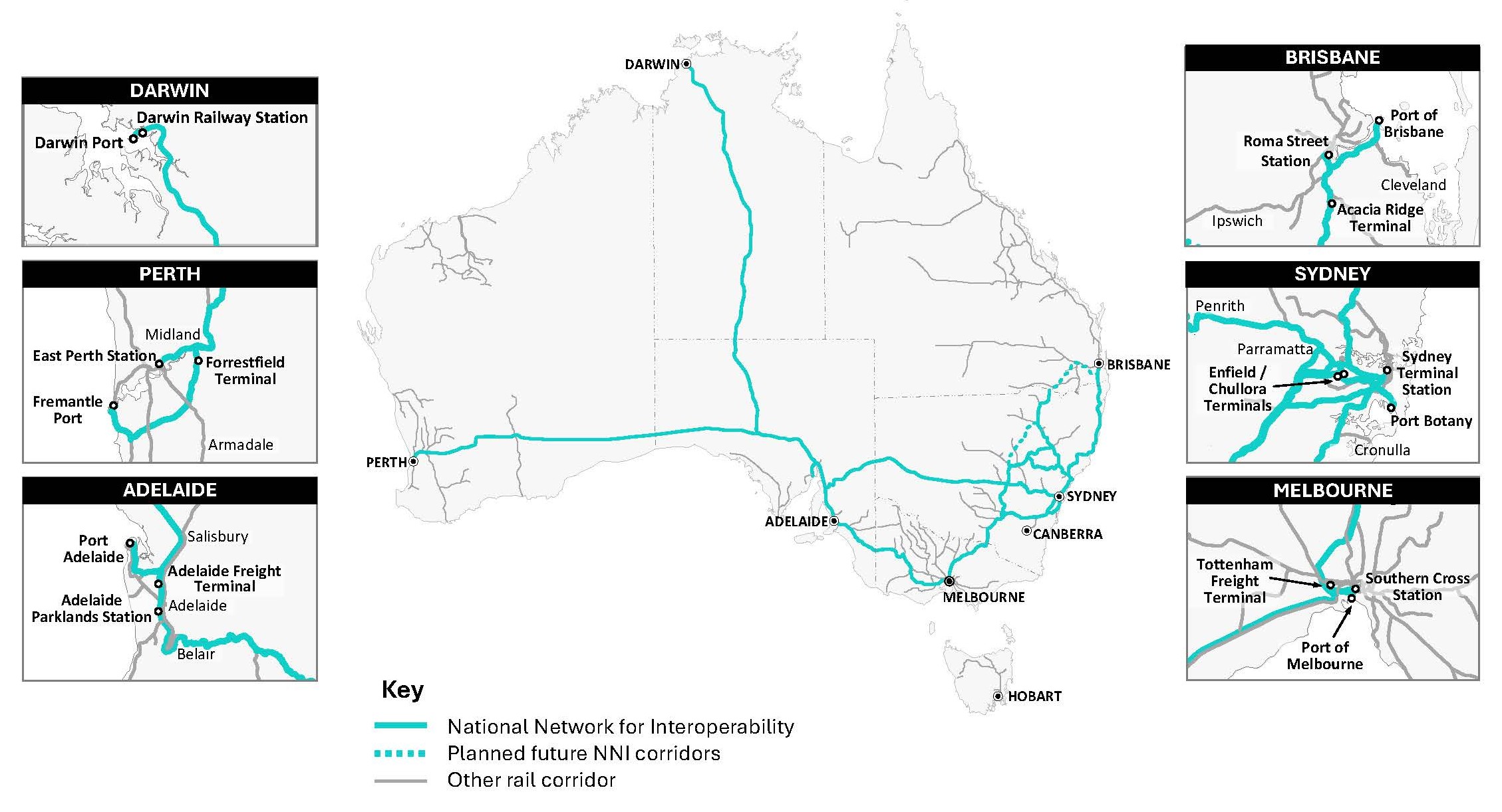
The NNI identifies the interstate freight and passenger lines between Australia’s major ports, regions and passenger terminals.
The NNI has been formally approved by Australia's Infrastructure and Transport Ministers and is published on the Office of the National Rail Safety Regulator (ONRSR) website.
An interactive version of the map shows the individual networks which make up these corridors, and the organisations which manage them. It also shows the important interfaces between networks where getting alignment is crucial to helping rail play a bigger role in the country’s economy.
Recent amendments to the Rail Safety National Law (RSNL) regulations require rail transport operators on these critical rail lines to consider national interoperability when planning changes to their railway operations.
An Interoperability Management Plan is required if interoperability matters are identified on the NNI.
The NNI will be updated regularly as freight and passenger networks expand and evolve.
To explore the interactive version visit here.
How to participate
If you have feedback, send us an email as we'd like to hear from you.
- Log in to post comments